Get your vario in time for Christmas: order now before Thursday 12 December 12:00
Menu
GPS logger and track recording
GPS and track recording
Tracks recorded
The internal memory of our GPS instruments ranges from 4 to 8GB. They can record between 10,000 and 20,000 flights!
To view a flight :
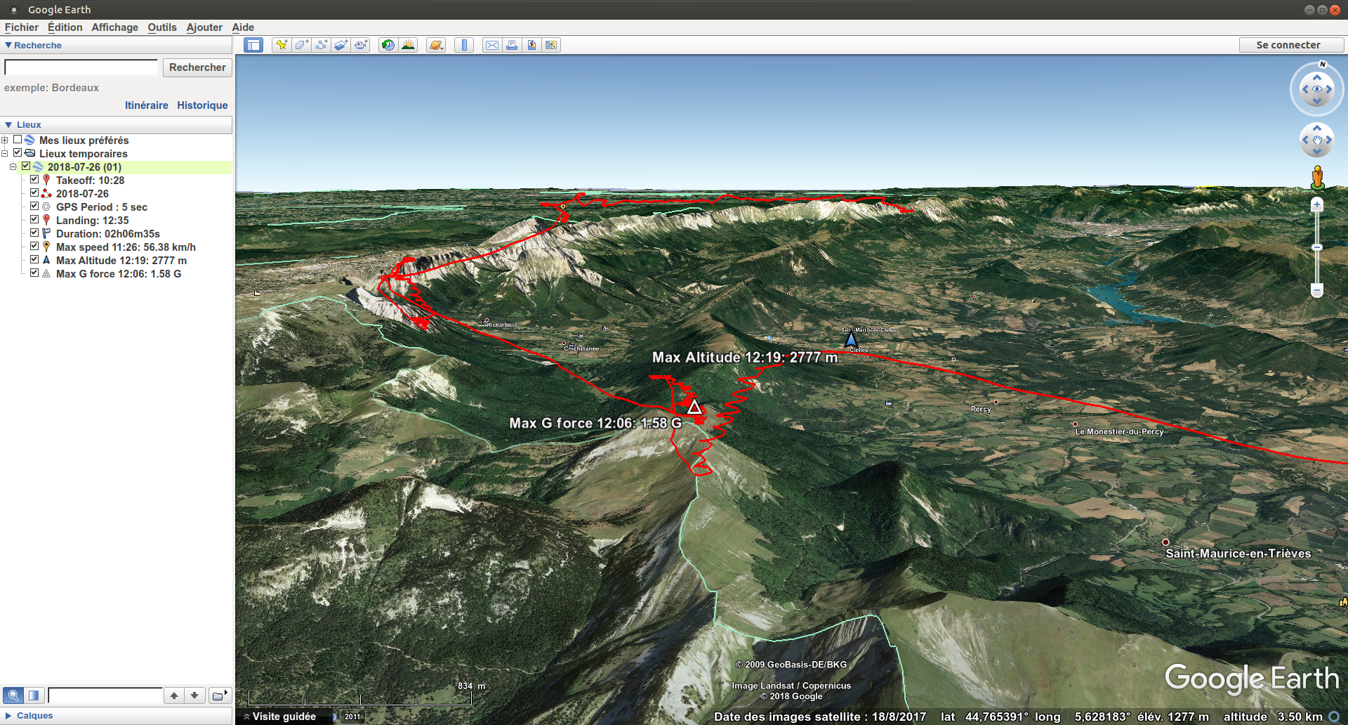
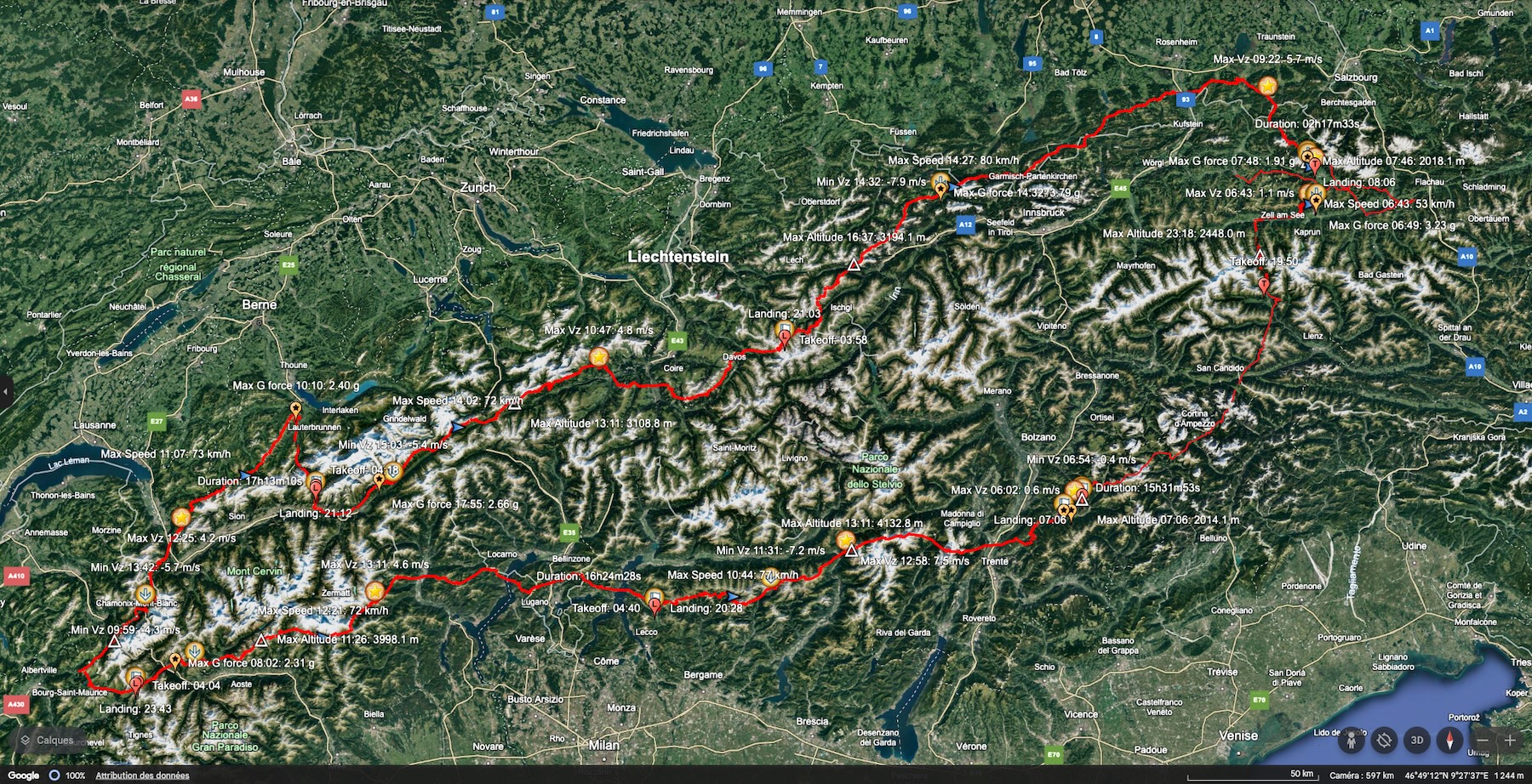
On landing, instantly visualise your flight in the Stodeus LogBook. Each track is recorded in IGC and KML, then automatically synchronised by Bluetooth via the app. BipLink.
In the LogBook, find your flights on a map, analyse your detailed statistics and track the wear and tear of your sails over time. For each flight, see your maximum speed, maximum altitude, distance covered and total time.
The IGC file generated by the UltraBip is FAI-CIVL certified, and is easily retrieved via Bluetooth using the Stodeus LogBook. You can then declare it directly on your federation's website (FFVL, DHV, SHV, USHPA, BHPA, etc.) or for your competitions.
Altitude management : As our instruments do not have a screen, they do not have the option of entering the QNH (pressure at sea level). This is therefore calibrated automatically by the GNSS (Global Navigation Satellite System, or GPS) before take-off. The longer the time between GNSS fix and take-off (with take-off detection enabled, by default), the more accurate the altitude calibration.
In flight apps, the QFE altitude can often be calibrated before take-off (using the known altitude on the ground).
Voice altitude announcement : This is the altitude obtained from the pressure sensor and initially calibrated automatically by the GNSS before take-off.
Altitude in the KML file : This is the altitude obtained from the pressure sensor and initially calibrated automatically by the GNSS before take-off, and updated at each point.
Altitude in the IGC file : Two altitudes are recorded:
Standard barometric altitude, without initial calibration
GNSS
Note on altitude display :
KML : It is possible, when flying close to the ground, for the ground to collide with the track: this is normal. GoogleEarth uses SRTM (Shuttle Radar Topography Mission) terrain heights with an accuracy of ± 20 m. As a result, the representation of the terrain in Google Earth is approximate. The slopes are incorrect and the peaks are planed out.
IGC : As 2 altitudes are present, depending on the IGC track viewer, pay attention to which one is displayed (uncalibrated atmospheric pressure or GNSS).
In LogBook Stodeus : The 2 altitudes in the IGC file (uncalibrated atmospheric pressure and GNSS) are visible.
Registration: Our GPS instruments record the track internally, even when connected to a smartphone. Provided, of course, that you have activated track recording in theBipLink app (function activated by default).